 Under Waters Oakland: According to the Lake, Griffith, and Stevenson Atlas from 1877, there was a town 3 miles northeast of Eldersburg called Oakland. This same map clearly shows what we would recognize as Liberty Road, which still takes almost the same route as it did in 1877.
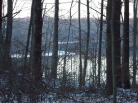
The town of Oakland is now at the bottom of Liberty Reservoir, north of the Liberty Road Bridge over the reservoir that leads into Baltimore County, the east bridge.
In 1877, the town of Oakland was alive and vibrant, with a wool mill and a manufacturing company providing plenty of work for residents.
Oakland would meet its end in 1950 but in the interim, Oakland sat peacefully on the bank of the North Branch of the Patapsco River. The North Branch is what we now know as Liberty Reservoir.
The map shows Oakland Road, which dead ends on either side of the lake now but at the time would have joined the two counties, meeting at the town of Oakland.
Today, one side of Oakland Road is off of Deer Park Road in Baltimore County, next to the Soldiers Delight area, and dead ends in the woods next to the lake. The other side of Oakland Road is off of Oakland Mills Road, and dead ends at the shoreline.
The old map also shows the towns of Eldersburg, Marriottsville and Sykesville. We would recognize some of the features from today that appear on the 1877 map.
The map shows the various homes of the Bennett family, after whom Bennett Road was named. The map also lists a town called "Mechanicsville" just east of Eldersburg.
Mechanicsville is also a lost town in some sense, absorbed by Eldersburg. The area where 7-11 is on Liberty Road in Eldersburg is was once called Mechanicsville.
One of the most interesting features shown on the 1877 map, a feature that is hidden on the Liberty Watershed today is Mineral Hill (Copper Mine), about four miles north of Eldersburg.
Today, the remnants of the copper mine include a few ditches and a huge pile of rocks. You can reach this ruin by taking the fire trail on the north side of the Route 32 bridge and walking east down the trail.
On the 1877 map, Mineral Hill Road clearly crosses what is now part of the lakebed. Today, one part of Mineral Hill Road is in Eldersburg, and the other part is off of Bollinger Mill Road, on the other side of the lake. It is hard to imagine the two roads being joined, and a copper mine on the hill.
There was another road that used to link Baltimore County and Carroll County, a road that hundreds of local residents traveled every day for many decades. A road that cuts through Liberty Reservoir.
On the Baltimore County side of the line, this road is called Nicodemus Road, and was a quick route to the Franklin Boulevard exit of 795 from the west side of the lake. On the Carroll County side, it is called Deer Park Road. There is a bridge between these two halves of the same road, the Nicodemus Road Bridge.
Closed since Oct. 2009, and likely to remain closed through 2011, the bridge at Nicodemus/Deer Park is being replaced. The bridge was in a state of dangerous disrepair, and certainly needed to be replaced however, the length of time involved has become a frustration for local residents, especially the inconvenience to traffic.
The lengthy closure of the Nicodemus Road Bridge also eliminates a favorite fishing spot, the bridge itself. Recreational fishing enthusiasts from both Baltimore and Carroll counties have enjoyed fishing from this bridge for decades, but for now they are forced to find other favorite fishing spots.
The closure of this bridge also eliminates a safe connection between biking trails on either side of the lake by breaking the connection between Deer Park and Nicodemus Road. Recreational boaters are also affected by temporary restrictions because of the closure of the Nicodemus Bridge.
Deer Park Road and Nicodemus Road exist on both sides of the county line. In 1877, they were two separate roads that both crossed over the North Branch of the Patapsco River.
The construction of Liberty Dam and the subsequent filling of the reservoir scrambled these two roads. One larger bridge replaced two smaller bridges. Now even that one bridge is closed.
Regardless of temporary bridge closings, there are still terrific spots for hiking and biking throughout Liberty Reservoir and its watershed.
Patch reader Pete Wetzel offered a description of one such trail in response to the first article in this series. Wetzel wrote: "The south end of Mineral Hill Road (now closed to traffic) is a great hike through a secluded glen that follows a babbling stream for a quarter mile down to the reservoir. And if you want to go farther, it turns east along a fire road that continues for four miles and comes out at Oakland Road right near the City of Baltimore Department of Public Works and the Carroll County water intake. There is ample parking where Pine Knob Road becomes Mineral Hill Road about a mile east of the intersection of Pine Knob and Rt. 32. There are two trails at that (fork). Mineral Hill is the trail on the right. The trail/fire road on the left is a pretty 1.1 mile walk (one way) that takes you back to Rt. 32."
There is a great spot for fishing that is rarely used, little known even to locals, and relatively difficult to reach. It is a peninsula on the south end of the lake, between Eldersburg and Marriottsville. The peninsula conceals an abandoned granite quarry, a hill made of straight-cut rocks and piles of granite slabs, now overgrown with underbrush and trees.
As you keep walking out to the end of this peninsula, you will be shocked to see the Liberty Dam, from the south side. It is rare that anybody sees the Dam from this angle.
If you move down shore, away from the damn, the peninsula also has a small inlet of its own. This inlet is home to massive catfish, and plenty of perch. Some local fishermen contend that if you cast out far enough from this Granite Peninsula, into the main channel of the lake, you can catch catfish weighing over fifty pounds.
Liberty Reservoir has miles of shoreline and acres of woodlands that are rarely visited by people. We will try to provide you with directions to find these special spots in the watershed in the next and final part in this series.
If you are reading this article, and want to share your favorite spots for walking, biking, or fishing around Liberty Lake, please post a comment or send an email to the author. Your descriptions might be included in part three of this series.
Enjoy Liberty Reservoir, and never forget your responsibility as its caretaker. If you tread lightly, we can pass on a beautiful, natural sanctuary to future descendants and residents.


0 comments:
Post a Comment